
About the author

Edward A. St. Germain created AmericanRevolution.org in 1996. He was an avid historian with a keen interest in the Revolutionary War and American culture and society in the 18th century. On this website, he created and collated a huge collection of articles, images, and other media pertaining to the American Revolution. Edward was also a Vietnam veteran, and his investigative skills led to a career as a private detective in later life.
1. Map of the Middle Colonies (1755)
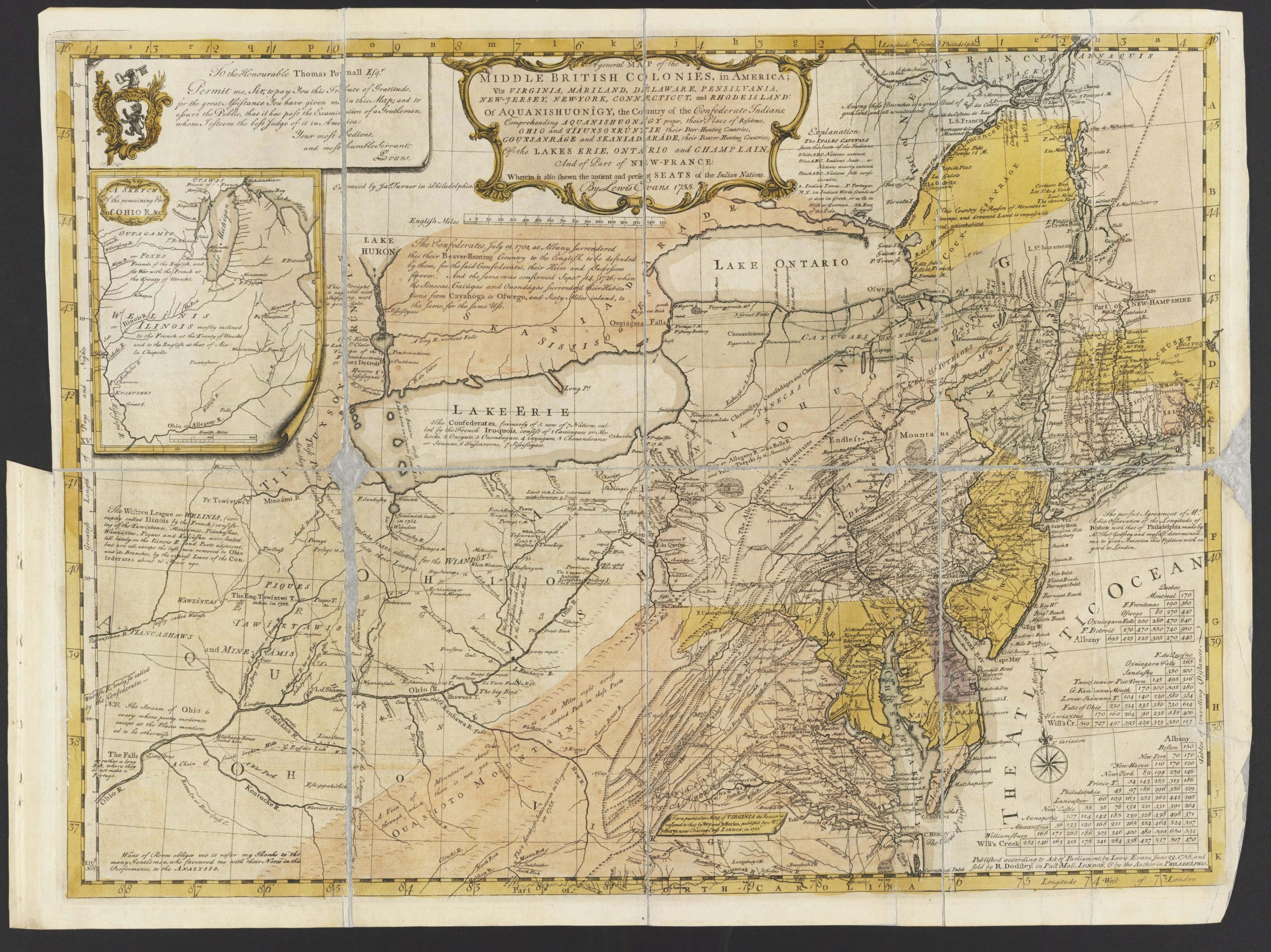
Philadelphia mapmaker Lewis Evans published this map just as the French and Indian War was beginning in the mid-1750s. Using recent surveys, he depicted not only the settled colonies but also roads, rivers, mountain ranges, the Ohio country, French territory, and the homelands and hunting grounds of Indigenous nations.
At the time, the western interior of the New World was contested by Britain, France, and Native nations. As a result, this type of geographical information had immediate military value – Benjamin Franklin supplied an early copy of this map to General Edward Braddock for his 1755 expedition against the French-held Fort Duquesne.
2. View of New Amsterdam (c. 1650s)
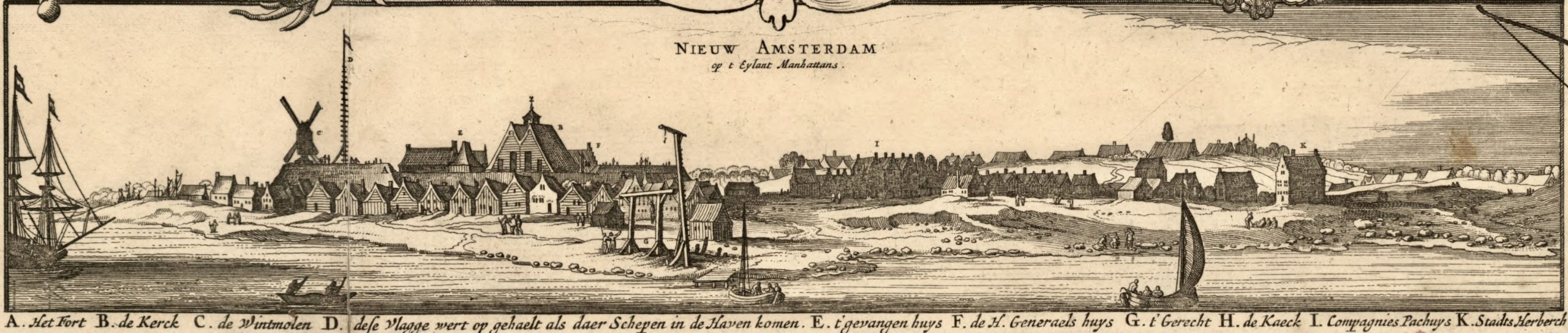
New Amsterdam was the administrative and commercial center of New Netherland. Fort Amsterdam guarded the settlement and harbor, while the stone church marked “B” was built inside the fort in 1642. The windmill and company warehouse reflect the town’s role in supplying ships and moving goods through the Dutch Atlantic trading network.
The English seized New Amsterdam in 1664 and renamed it New York, but its Dutch population, buildings, and mercantile culture remained throughout the region’s colonial history.
3. Philadelphia Dance Assembly (1750s)
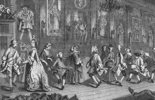
Philadelphia’s Dancing Assemblies began during the winter of 1748-49. The first season consisted of nine official gatherings, and acted as a way for wealthy residents to socialize, network, and enjoy themselves.
The earliest events were held in Hamilton’s warehouse on Water Street, close to the Delaware waterfront where many of the city’s leading merchants lived and worked.
These were carefully regulated elite occasions rather than public dances. Tickets controlled admission, sets and partners were organized according to written rules, and separate rooms were provided for guests who preferred to play cards rather than dance.
4. Windsor chair made in colonial Philadelphia (1760s-1770s)
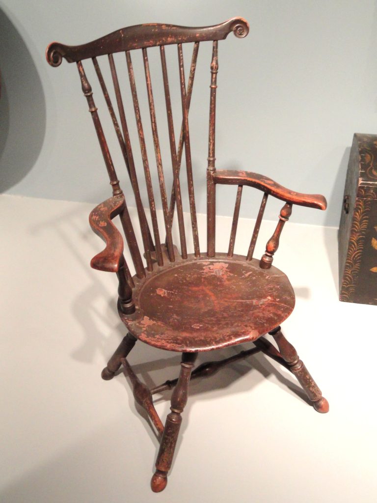
This is a contemporary photo of a Windsor chair produced in colonial Philadelphia, shown on display at the Art Institute of Chicago.
The chair is estimated to have been produced in the 1760s or 1770s, and was made out of a mixture of tulipwood (seat), maple (legs), and hickory and oak (likely the back and other thinner components).
This piece was hand-crafted and took time to create, but Windsor chairs were produced en masse and would have been seen in middle and upper-class households throughout the Middle Colonies.
5. Woodcut showing farm life in colonial New York (1761)
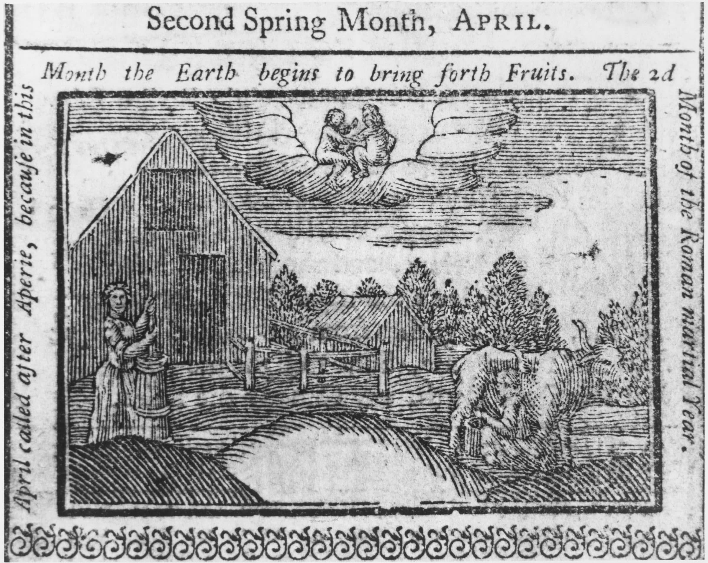
This woodcut, seen in an annual almanac produced by John Nathan Hutchins, shows one woman milking a cow and another churning butter on a farm in New York. The scene focuses on the month of April, describing it as the time of year when nature springs back to life after the winter months, and activity on the farm intensifies.
The almanac was a short annual publication that helped colonial New Yorkers plan for the year ahead, and also contained other entertainment content. This image was used as an illustrative example in the 1761 edition to show rural life in the colony – it was not designed to represent a specific farm or farm workers.
6. Bernard Ratzer’s Plan of New York (1766-67)
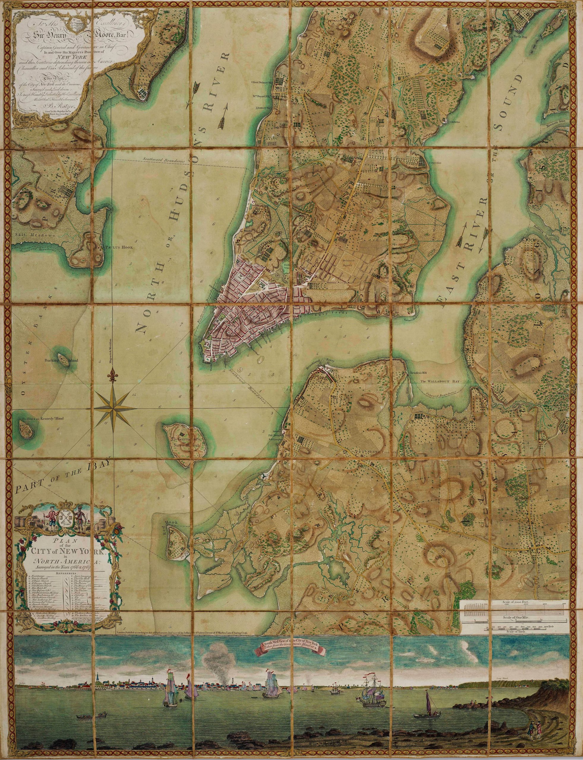
British authorities expanded their survey of New York after the Stamp Act protests of 1765 demonstrated the need for better military knowledge of the city. Ratzer recorded the dense settlement at Manhattan’s southern tip as well as roads, estates, fields, streams, fortifications, parts of present-day Brooklyn and Queens, and the islands and channels of the upper harbor.
The result is one of the most detailed records of New York immediately before the Revolution. It captures both the compact colonial port and the largely rural landscape that still covered most of Manhattan at the time.
7. Great Cohoes Falls on the Mohawk River (1768)
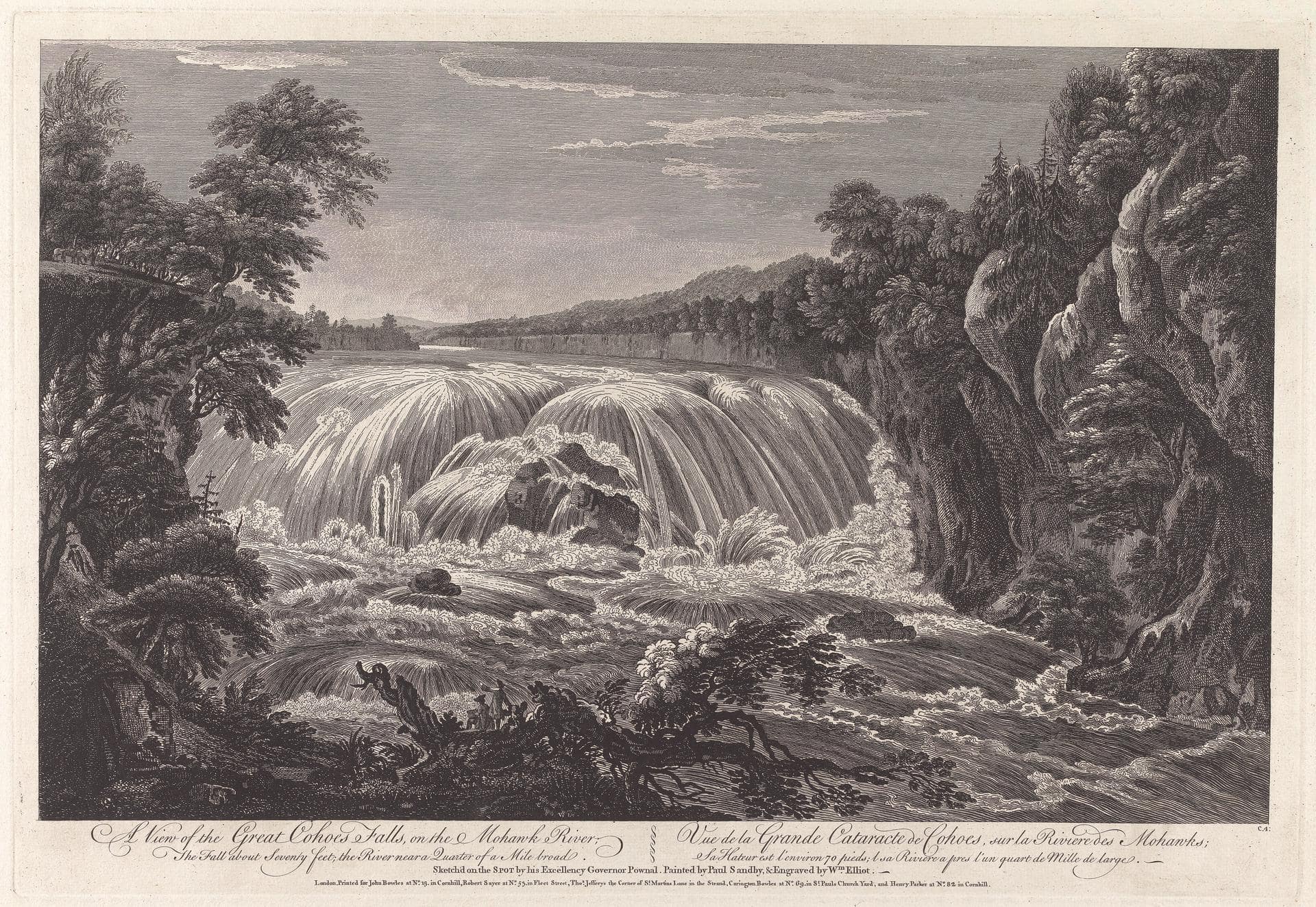
The inscription describes a waterfall of about 70 feet in depth, and a river nearly a quarter-mile wide.
Located near present-day Cohoes and Waterford, New York, the falls stood along the Mohawk corridor – the principal natural route westward from the Hudson Valley into the North American interior, which was essential for colonial trade.
8. New York City skyline (1771)
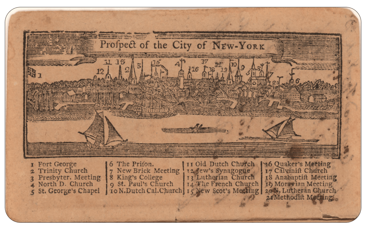
Many of the most prominent buildings in this image are churches, reflecting New York’s unusual level of religious diversity. The key identifies Anglican, Dutch Reformed, Presbyterian, Lutheran, French Huguenot, Quaker, Moravian, Methodist, Baptist, and Jewish places of worship, alongside landmarks including Fort George, King’s College, and the city prison.
This image also shows New York’s history as a Dutch trading settlement and its continued role as a port of entry for migrants into the New World.
9. Idealized view of the Port of Philadelphia (1770s)
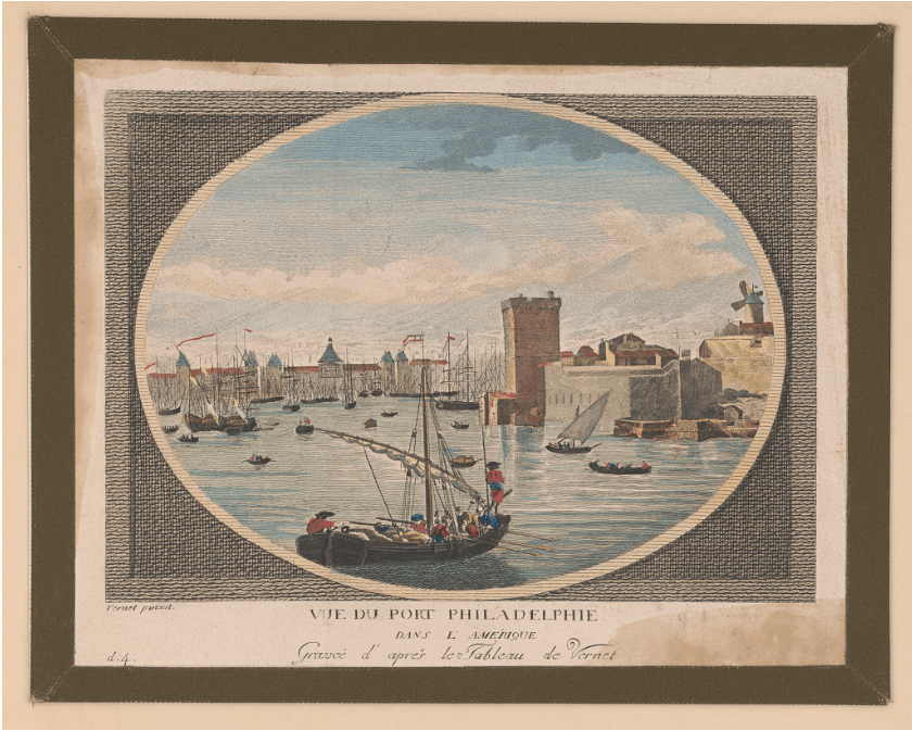
This image should not be taken as an exact record of what the Port of Philadelphia looked like in the late colonial era. Its substantial waterfront buildings, windmill, small craft, and oceangoing ships present Philadelphia as a prosperous European-style port to an overseas audience. The bilingual German and French inscription identifies William Penn as the city’s founder and explains that “Philadelphia” expressed his hope that its inhabitants would live together in harmony.
The busy harbor nevertheless reflects the economic reality of the city. By the 1750s, Philadelphia had surpassed Boston as British North America’s busiest port. Ships carried the region’s flour, grain, flaxseed, lumber, and iron products to Britain, southern Europe, the Caribbean, and other colonies, returning with manufactured goods and imported commodities.
10. Woodcut showing harvesting on a farm in Philadelphia (1759)
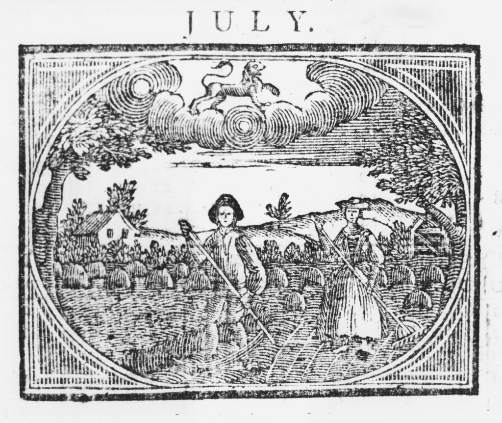
Another woodcut from an annual almanac, this image shows a couple on a farm harvesting their crop, with cut grain, a farmhouse, and a barn in the background. The man is shown holding a scythe, which was used to cut down the crop, and the woman is holding a rake, used to gather what has been harvested.
This image was used to represent the month of July in the almanac, which was the peak harvesting season in colonial Pennsylvania, especially for crops such as wheat, rye, and barley.